

 |
 |
 |
 |
 |
| PAUL
GLOVER ESSAYS: community
control of food, fuel, housing, health care,
planning, education, finance. |
| HOME | INTRO | CURRENCY | SUCCESSES | HOW-TO BOOK | PUBLICITY | ESSAYS |
| In 1977 I started a campaign to
put an end to a plan to build a 4-lane highway through
Ithaca. The plan had advanced by pretending to
untangle the notorious "Octopus" traffic jam. It had already
received state and local approvals, and $50 million funding was
committed. ---The Final Environmental Impact Statement had been approved. The time for public comment had ended. But this article forced the NYS DOT to hold another public hearing, where hell broke loose. ---A dedicated group of Ithacans met monthly for the next 12 years, before the state finally abandoned the highway plan. The Octopus:
Where are we being led? by Paul
Glover * June 30, 1977, Ithaca
Journal
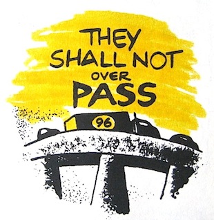
The Octopus will become a Giant Squid. The people who brought you the dangers and aggravations of driving to and from West Hill across the Octopus intersection are designing a slick new highway which will make the problem worse. Instead of relief, long-suffering Ithacans are being led into traffic jams more tangled than ever before. It is hard to believe, but the Environmental Impact Statement (EIS) for proposed Routes 13 and 96 explains why. These two major four-lane limited access divided highways, elevated over the city, are being designed to provide for "interregional travel needs" such as tourism and industrial expansion, and to promote the "eventual suburbanization" of Tompkins County. Planners admit that the new Route 96 would leave 75 percent of the present traffic load still in the Octopus (p.8 EIS). However, far greater numbers and a growing proportion of this traffic will be West Hill commuters, trying to navigate the difficult turns to or from Hector Street, Elm Street, and Floral Avenue. A manifold increase of future West Hill apartment dwellers and suburbannites is being lured to that area by developers (pp.29, 94, Map 9 of EIS; General Plan Map 2.3; Mayor Conley at Albany D.O.T. meeting Oct. 26, 1972), thereby aggravating the congestion. Thus, residential commuters will wallow in the intersection as regional travellers zoom past overhead. The Octopus will persist, more powerful than ever. |
| The
City's Superintendent of Public Works, Robert Dingman, has written of
the proposed roads: "It is my feeling that the arterial law was enacted to enable the state to build highways within cities to aid those cities in handling its commuter traffic. The inter-city planning approach presently used by the Department of Transportation does not meet this purpose" (memo, April 14, 1970). The NYS Department of Transportation, explaining its "primary goals," confirms that "the improvement of this section of Route 96 can be recognized as fulfilling the object of providing for interregional travel... in the corridor" (p.4 EIS). Nor can new 96 be justified by "waving the bloody shirt" for quick access to the hospital's emergency room. Common sense would expand our emergency medical facilities downtown at the center of population. A clinic is being planned in the city, and should offer emergency care. Similarly, the much-feared invasion by crosstown coal trains is itself spurred by the new highways, which attract industries that demand more electricity (pp. 79, 103 EIS; NY Power Pool Report-- vol. 1). Indeed, planners have not even certainly decided to elevate 96 over the railroad tracks (p.29 EIS). The desperate need of a second bridge haunts West Hill, bemoaning the plans for Route 96. Is the expense of another bridge too much for the city to undertake alone? "We're fast approaching the million dollar mark in officers' time to control traffic [at the Octopus]. For that, we could have built another bridge" (Police Commissioner James Herson, Ithaca Journal, May 10, 1975).  Such a bridge, cutting the Octopus in half, could serve us relatively soon. The disastrous 96 would not be ready for seven or eight years. Of the nine alternatives to construction of a new 96 described in the Environmental Impact Statement, none included the effective second bridge solution (Section 5, EIS). A second bridge will be needed, sooner or later, even after a four-lane 96 is built. The Environmental Impact Statement indicates that the expressways would increase traffic through the Ithaca area by 22 percent (p. 8 EIS). This will require widened streets, more one-way streets (Buffalo and Court), restriction of left-turns, and further limitation of on-street parking (pp. 30, 81, 114, H-7, EIS). A City-sponsored study concluded that eastbound traffic from the new 96 would cause "more severe and additional problems to develop" (Ithaca Journal, March 24, 1974). As one County planner explains, "The nature of planning and widening more roads both anticipates and encourages more vehicular traffic. Therefore, all streets will find significant increases in number of vehicles" (p. 137 EIS). The roads would destroy as many as 59 homes and 38 businesses (pp. 23, 79, D05, D-6 EIS) thereby taking $176 millions of taxable property from Ithaca's base (p. 22 EIS) and raising the local tax rate. This dislocation, involving 13,600 acres of Ithaca City and Town, is not considered a "significant" environmental impact, although a petition of over 300 Ithacans in the vicinity of the road opposed the intended Rte. 96 corridor (Ithaca Journal, Nov. 13, 1973). Higher water and electric bills are part of the hidden price, or "secondary impacts," of these proposed routes (p. 28 EIS; NY Power Pool Report-- vol. 1). Rent rates, already the highest in the 15-county Upstate New York region, will increase (D-3, D-4 EIS). America's large cities are object lessons that urban growth reaises the cost of living. Yet, many downtown businesses look forward to the greater volume of tourist dollars brought here by the roads, unaware that Triphammer-like commercial growth (p. 20 EIS) will shift Ithaca's commercial center from The Commons toward the West End (p.32 EIS). Only the strongest businesses could survive this shift. Crowding of the parks (pp. 30, 70 EIS) and ever-greater air, water, and noise pollution throughout the area are also expected (sections 3,4 EIS). With characteristic understatement, the report acknowledges that "...some additional disturbances may confront abutting property owners." But these, from the vantage of Syracuse planners, will be "minor" (p. 81 EIS). They suggest that living next to a superhighway "can be pleasant" (p. 18 EIS). The Department favors "quieter noise" when possible (p. 56 EIS), but if sixteen-foot high noise barriers do not bring noise levels withing "acceptable" Federal |
 Highway standards, then "FHWA will be requested to grant an exception" to their regulations (p. 117 EIS). After all, future development "will acclimate people to a noisier environment which will probably make the addition of a still noisier environment less offensive" (p. 59 EIS). Although the new Route 96 would overshadow the Cass Park playground as it begins to climb West Hill, crating "moise levels anticipated to exceed the maximum levels compatible for recreational use" the proposed highway "will not alter the use of the parkland" (p. 117 EIS). Indeed, planners believe "the sweeping elevation of 96 over Cayuga Inlet and the Flood Control Channel could provide much aesthetic background for Cass Park" (p. 117 EIS). On the other hand, destruction of the Garden Club tree grove by this overpass has "no aesthetic impact" (p. 118 EIS). It is the road itself, grand monument to the rat race, which supposedly improves the appearance of Ithaca: it is designed so that tourists can see "the area in its most interesting light, providing a variety of visual experience, or minimizing unsightly features that exist" (p. 73 EIS). Like interior decorators arranging furniture, they speak of making their roads "as attractive as possible" so they "will complement the visual features and landmarks of the area" (p. 73 EIS). A scenic overlook intended for Route 96 would be situated to display the lake and Pyramid Mall beyond. Travellers could appreciate a panoramic view of Route 13's splendid lakeside scar (p. 208 EIS). The Environmental Impact Statement is inconsistent regarding air pollution. It is actually claimed that air quality will be improved by the construction of roads, until 1985, when according to graphs, projected carbon monoxide pollution becomes worse than ever (pp. 65-66 EIS). Immediately after construction, however, "an increase in pollution will occur" (p. 79 EIS) where old and new roads run near each other. But we will suffer no "significant" ill health from bad air, they conclude, based on carbon monoxoide samples taken at two sites. One of these sites is one-half mile upwind from the roads and 150 feet above them (p. 61 EIS). The marshy Inlet wetland south of the City is "habitat for muskrats, mink, raccoons, pheasans in winter, grose, woodcock, ducks, geese, deer, game fish... and various other birds and wildlife" (p. 39 EIS). The Route 13 corridors preferred by the NYS Department of Transportation would tear through the middle of this area, splashing a wide wake of foul air, noise, and contaminatedwater runoff onto these beasts. Road planners boast that "no wildlife refuges are affected by this project" (p. 43 EIS). They then mention that, for what it's worth, "Any migratory birds will have to adjust to a slightly changed environment... (p. 80 EIS), "siltation from highway construction... would smother plants, fish eggs, and other organisms that inhabit the stream bed" (p. 43 EIS). And after the roads are built "There will be some secondary impacts on [destruction of] wildlife in the area due to the encroachment upon wooded lands for construction such as housing needed to produce the economic growth desired" (p. 44 EIS). The NYS Department of Environmental Conservation says more directly, "If this project stimulates the residential and industrial growth stated as a goal, the long term impact on wildlife is expected to be widespread and irreversible" (p. 189 EIS). Car exhaust and salt would enter the many creeks that supply the Lake. Along West Hill, Williams Brook and Indian Creek "will facilitate the drainage of highway runoff into the Cayuga Lake." The presence of such a huge road cut athwart the many hillside creeks will "inhibit turnover and natural mixing of the lake" (G-9 EIS). Soil chopped out for the road would be trucked across the Octopus to cover 100 acres of City land four to eight feet deep, in preparation for industrial development (p. 51 EIS). According to the Central New York Regional Planning and Development Board, "... the highway would not be desirable even if it were free" (Official Review of Draft EIS 8-73). Knowing all this, what benefit is there to buiding such roads? If superhighways damage Ithaca this way, then whose interests do they serve? The answer is not merely that students will have an easier time of "long distance travel between semesters, " nor are the roads coming just to "facilitate the movement of military vehicles, men, and equipment..." (p. 33 EIS). |
Forces
unseen make roads for reasons bigger than these. Thirteen years ago a group of industrialists, led by financier Robert L. Mattern, crated a three-state Economic Development Council and began lobbying state and federal governments for construction of an "Appalachian Thruway." This superhighway, from Maryland through Pennsylvania up Route 13 to Ithaca, connecting to Route 81 at Cortland, was to be an extraordinarily commercial promotion gimmick. "Unlike other highways, the Thruway was not justified on any traffic counts, but was designed to promote future industrial development" (Appalachian Thruway News 7/75). By 1965, the Development Council succeeded in enabling 13 counties in New York state, including Tompkins, to be eligible for federal highway money through the Appalachian Regional Commission. "The Appalachian Thruway is being financed in part by the Appalachian Regional Commission as a development highway" (Ibid). The plan went forward with the cooperation of the Major Employers' Group of Tompkins County: "Stimulation of economic growth is essentially the primary goal of the Economic Growth Center's Highway Demonstration Program established by the 1970 Federal-Aid Highway Act. The Ithaca, N.Y. area is one of the tree areas in New York State designated as an economic growth center and Routes 13 and 96 in the Ithaca area have been designated as economic growth center development highways" (p. 4. EIS). The business and political leaders who direct the economic life of Tompkins County are doubtless proud of this accomplishment and the of the future they plan for the rest of us. Were anyone ungrateful enough to oppose economic growth because they preferred clean air, open spaces, lower prices, and diret solutions to local traffic problems, then these potentates would pat our heads and remind us of "Jobs!" It is a powerful word; they know we will follow them anywhere. But it is a miserable exchange. Whatever jobs are gained are soon lost as more people migrate here to to compete for wages. "Morse Chain reports that 48 percent of its employees commute to work from other counties, and other firms have reported between 30 and 40 percent of their employees doing the same" (p. 3 Housing 5, 1976, Tompkins County Planning Department). Therefore, "Transportation access within this region would make it possible to assemble larger groups of employees" (p. 36 EIS). Unemployment is part of the American Way of Life, since industrialists have a vested interest in keeping some unemployed workers available to make labor unrest less likely. "It should be pointed out that in a market economy it is desireable to have some unemployment to maintain healty competition among labor" (p. 37, Human Resources 3, 1974, Tompkins County Planning Department). "The existence of some surplus labor [jobless people] and a history of relatively low average pay rates are positive, attractive forces for firms considering locating in the area" (p. 8 The Economy 3, 1974, Tompkins County Planning Department). Source materials for Ithaca's Community Development Program, 1975, indicate that "potentially suitable growth industries" likely to locate here would offer "under 33 percent" of their jobs to women and would pay a "very low-medium" annual wage (p. 104). Casual readers of the Environmental Impact Statement for Routes 13 and 96 would scarcely recognize it after reading this article. Its 370 pages are padded with soothing twaddle ("The impacts of each option will be identified and measures which can be taken to mitigate the impacts will be discussed"), and written like Orwellian Newspeak, to replace vivid emotionally suggestive prose with benumbing technological abstractions. Where the report could refer to Construction, Road or Damage, it says instead Improvement, Project, and Impact. Not surprisingly, the Syracuse director of D.O.T. does not want to hear "emotional outbursts not founded on fact," in response to the highway plans (Ithaca Journal, June 30, 1976). He informs us that "the Final Environmental Impact Statement is a document to reflect citizen input, not to solicit their input" (correspondence, July 30, 1976). The official time limit for "community input" has ended, but an outspoken community response should begin. A clear choice must be made by Ithacans right now, before this pleasant valley becomes forever grey. "It is New York State policy not to construct highways that do not receive local sanction... and the Department of Transportation is prohibited by law from constructing a highway in a city without the formal approval of the city council" (p. 92 EIS). Our City Council approved the road construction only five days after receiving copies of the initial Impact Statement on June 22, 1973. Call your local representatives and write Joseph Powers (Director, Region 3, D.O.T., 333 East Washington St. Syracuse NY 13201) to request a public hearing before September. Highway designers are finalizing their plans. We can send them back to Syracuse, then remake Ithaca for the enjoyment of our lives. |
| HOME | INTRO | CURRENCY | SUCCESSES | HOW-TO BOOK | PUBLICITY | ESSAYS |